
Image Courtesy of Flickr.
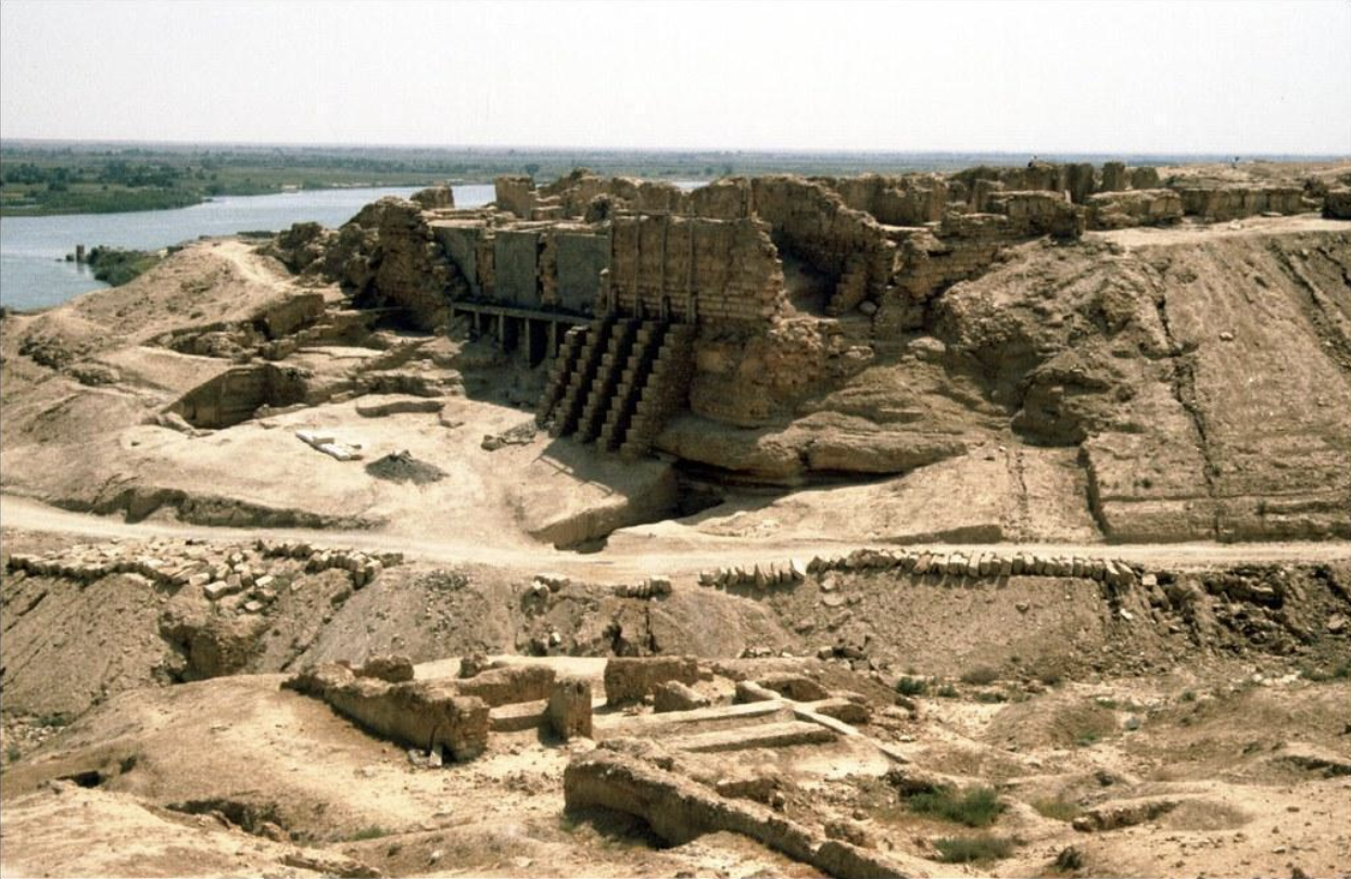
When walking through a museum or examining historical texts at Beinecke Library, true understanding starts when you can visualize yourself living in these civilizations, immersed in the local culture and embracing their way of life. However, due to natural erosion and looting, it is becoming increasingly difficult to enjoy physical archeological sites. One of these sites is Dura-Europos. Founded around 300 BC and located along the Euphrates River in modern-day Syria, Dura-Europos was a critical site for cross-cultural trade. This site boasts the earliest evidence of a house church, and there are inscriptions and graffiti written in Greek, Latin, Persian, and Hebrew because of its proximity to the Roman and Persian Empires.
The city came to the attention of Western scholars in the 1920s when British soldiers in the area came across some of the wall paintings from Dura-Europos. In the 1930s, Yale archaeologists were part of a Temple that excavated the site. As a result, Yale University has one of the largest collections of artifacts and documents from the ancient city housed in the Beinecke Rare Book and Manuscript Library, the Peabody Museum, and the Yale University Art Gallery. However, Dura-Europos cannot currently be investigated due to the Syrian Civil War. How can we walk through the ancient bustling town and experience day-to-day life without ever physically visiting the archeological site? The answer lies in a magical collaboration between the past and the present.
In 2007, Holly Rushmeier, John C. Malone Professor of Computer Science, came across thousands of field photos of Dura-Europos in the Yale Art Gallery. “I was interested in apply[ing] computing for preservation and documentation of local cultural heritage and using the photos to craft a digital representation of the society,” Rushmeier said. However, she ran into an issue with the images as they were far too grainy and sparse for automatic 3D generation that many modern phones can accomplish. Also, there was too much cross-institutional material and international research. She needed help to somehow piece the photos together based on location and relevance to map out the city as a whole. Fortunately, Rushmeier met Anne Chen who was a fellow at the ARCHAIA program at Yale and had all the expertise needed. Chen, now an Assistant Professor of Art History and Visual Culture at Bard College, had experience studying both Roman and Persian empires and an interest in implementing Linked-open Data to the site’s research.
Linked-open Data is a Wikilink-like concept that brings together data and resources from all over the world into one platform and connects them based on knowledge webs. A way to categorize the data is through “Urban Gazetteering”—classifying architectural structures and cataloging them by location so they can be distinguished online. This process works at a macro-level. It differentiates between settlements and improves keywording so specific buildings can be easily identified across the various settlements around the world. However, it does not yet work at the micro-level, as they still need to distinguish similar sites across the street from each other in the same city. Similarly, excavation reports were inconsistent, so connecting them proved to be a big challenge. They still needed historians, linguists, and archeologists in the area, as well as data scientists to work together to parse information while making it available and accurate across many languages.
With any Wikidata or database project, using more data improves the accuracy of the entire workflow. In the future, Chen and Rushmeier plan to integrate artifacts in Damascus that have not yet been accounted for. They also plan to implement more of Yale’s database of Dura-Europos into Wikidata and potentially use computer vision or AI to categorize the data more efficiently and accurately. Furthermore, they plan to improve view spaces to increase accessibility for interested researchers and the public. By expanding the public interface, more researchers can exchange original findings and view different interpretations to translate them for modern understanding.
Most importantly, both researchers aim to make the technology available to everyone. “Lots of locals were interested in the site, but there was no information available in Arabic despite the site being viewed as a textbook example in the US,” Chen said. Oral traditions have materialized around the site and thus the naming conventions of the buildings are all varied based on local language. It’s their goal to make the new Linked-Open Data translated for all local users, so anyone and everyone can virtually walk through the ancient Dura-Europos.